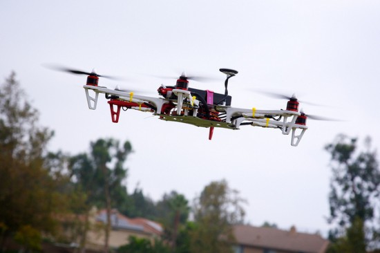
Seven Ways Buyers Will Use Drones in the Coming Years
By Deborah Rutter
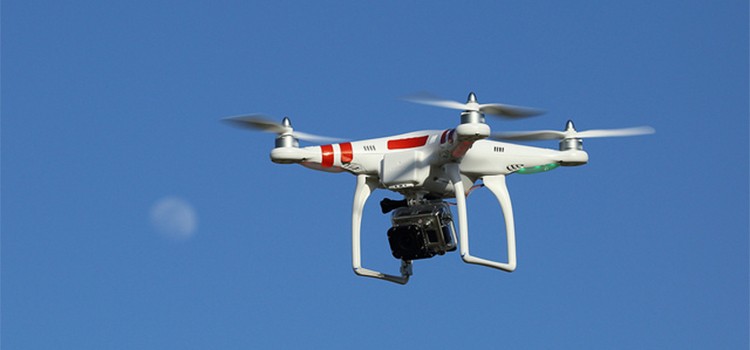
Most good listing agents know the value of a professional photographer and what great pics, lighting and staging can do to help show a home at its best. But beyond cameras, some photographers (and others who don’t shoot pics for a living), are beginning to use drones to expand services to agent and clients alike.
Drone-use may sound trendy, and perhaps foster visions of an invasion of privacy, or be the next controversial hot topic. To some extent, all of those things are true. But savvy buyers in our mostly rural area of central Virginia will beginning using drones to help make smarter, quicker buying decisions. Here are seven ways intelligent drones (or as the FAA calls them, “unmanned aircraft systems” or UAS’s) could be used during a purchase:
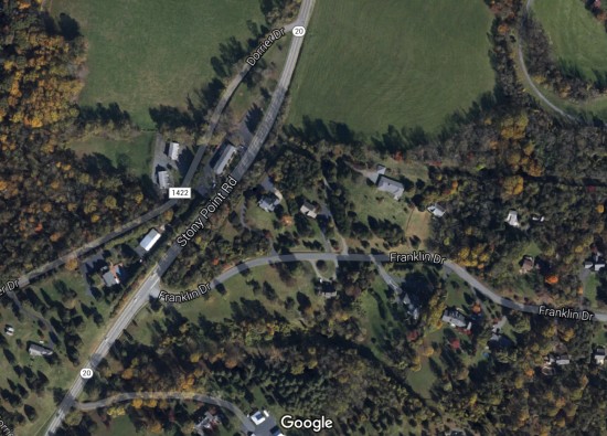
1) Confirm Google Earth! Many of us have used Google earth, maybe for fun, to fly over our own house or neighborhood. But many of the Google Earth images are older and properties are always changing; new additions, land changes, more or less clearing. A drone fly-over of a large parcel (or not so large) can quickly be compared to online images to track changes.
2) Help with New Construction Site Location: If you’re thinking about building a home, and capturing a particular view is key, a drone can help. Forgo the hassle of ladders or bucket trucks, which aren’t able to access some locations, or simply hoping the view will be stellar. A hovering drove at the right height can capture a 360 degree view and allow you to determine an ideal build site. It can reveal where sheds exist, identify which trees to remove, and even which neighbors will be visible or hidden. Drones can also help quickly confirm where the best location is on a large parcel for the driveway to meander, the outbuildings to be placed, and identify existing clearings that might not be obvious, etc.
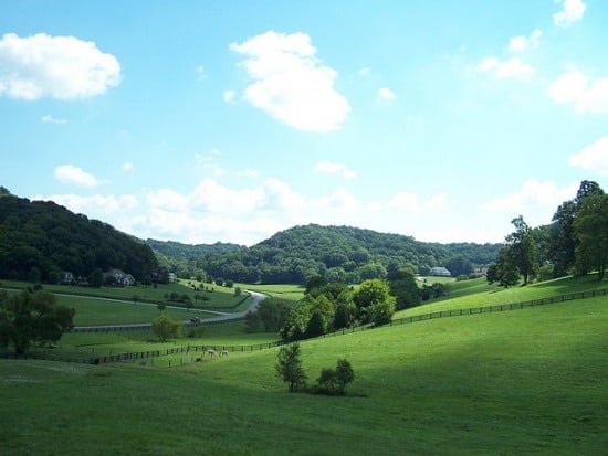
3) Supplement walking the property: Every buyer agent knows that the best advice for anyone buying property is to get out, on foot, ideally, and walk the land. See it up close from multiple angles to get an idea of soils, views, trees, etc. But sometimes time constraints, sudden bad weather, inaccessible areas due to distance, overgrowth, livestock, and the like might making reaching all of the land on foot (or even in a vehicle) tough or impossible. A drone can help see the areas not easily accessible, and spot things like locations of electrical poles, junk left behind in a ravine, sites of old garbage burns (burning household rubbish is a legal way to dispose of trash in Albemarle County), etc.
4) How far away…REALLY? So, the map might say one thing, the neighbors another, the agent yet still a third opinion. How far away IS that rear neighbor? The railroad? The dump? Certain times of the year in central VA, the overgrowth is amazing. We have a robust, sunny, and moist climate most of the summer which means we get a lush, green landscape, but that can also obscure things that might change pretty dramatically when the leaves have fallen. An aerial shot can give you a much better idea of not only what is around beyond what is mapped, but give you a real idea of distance, position, etc. of the issues with adjacent parcels.
5) The final walk-through: The most-commonly used contract in central VA allows for a final walk-through just prior to closing. For practical or timely reasons, it may not be realistic to go over every square inch of a large or challenging parcel on foot to confirm removal of items, fencing repairs, other issues as a result of the inspection, or just a general overview of the parcel’s condition prior to accepting the deed. A combination of an in-person visit and drone fly-over can be a good way to complete the walk-through on multiple fronts, ensuring the best overview before taking possession.
6) Insurance: Every insurance agent will tell you that taking pictures or video is helpful when making a claim. Having a thorough video of the entire parcel, showing land coverage, structures, other improvements, and their locations can help speed-up a claim if a fire breaks out or a storm creates havoc making some areas inaccessible for long periods of time, etc.
7) Understanding the neighbors: Your best advice is always to talk to the adjacent neighbors before buying, and have conversations about your possible purchase. You’ll get to know your future neighbors, and that’s important. Politely inform them that you are going to be capturing drone footage of the land/home you are purchasing, and it may include images of their property. Be sure that the drone flies only over the property you are purchasing, not theirs. Yes, this seems creepy. And invasive. It is—it’s what everyone fears about drone use. But your neighbors can impact the value of your property. If the neighbors are hosting heavy metal band practice, raising pigs, or have massive deforestation plans, it can impact the future resale of the home. There’s no way around that. So be a good neighbor and be open and honest about your drone usage.
Safe, legal FAA-approved drone usage is growing, but still very new, and laws are changing and being updated by the month. The latest changes just occurred in December of 2015—requiring that anyone who shoots drone footage for business use needs to abide by one of three approval methods listed below. Don’t settle for anything less.From the FAA site:
1. Special Airworthiness Certificates – Experimental Category (SAC-EC) for civil aircraft to perform research and development, crew training, and market surveys. However, carrying persons or property for compensation or hire is prohibited. For more information, please contact the Airworthiness Certification Service, AIR-113, at 202-267-1575.
2. Obtain a UAS type and airworthiness certificate in the Restricted Category (14 CFR § 21.25(a)(2) and § 21.185) for a special purpose or a type certificate for production of the UAS under 14 CFR § 21.25(a)(1) or § 21.17.
3. Petition for Exemption with a civil Certificate of Waiver or Authorization (COA) for civil aircraft to perform commercial operations in low-risk, controlled environments.
That last thing you want as a potential buyer is legal trouble, upset neighbors, a seller who doesn’t provide permission, or a device being flown on your behalf that creates an accident or incident.
Drone-flights are on the cutting-edge frontier of real estate. They are not common now, but likely will be in a few years, and some applications are already are already being used (legally and NOT legally). See the FAA’s site on UAS’s here.
Wondering is this is right for you and your upcoming purchase? Talk to a Nest Realty agent about the possible ways this might add benefit and insight, then remember to follow the FAA rules moving forward. Happy aerials!
Deborah Rutter is an Associate Broker at Nest Realty with passion for teaching. She knows buyers and sellers make the smartest decisions for themselves when they are armed with data and insight. She has taught first-time homebuyer education classes, and is a featured contributor on our blog. Check back for insights and advice or contact Deborah directly to discuss your buying or selling needs.
Tiffany Morris
Written on
Drones are paving their way to the market of technological advances and a lot of people have taken the benefit from them. Be it a personal or business use, drones are really popular today. As a gadget reviewer, I have been able to test a few of them and my personal favorite is the DJI Phantom 3 Professional Quadcopter Camera Drone and others on this link: http://topproducts.com/reviews/best-drone.htm